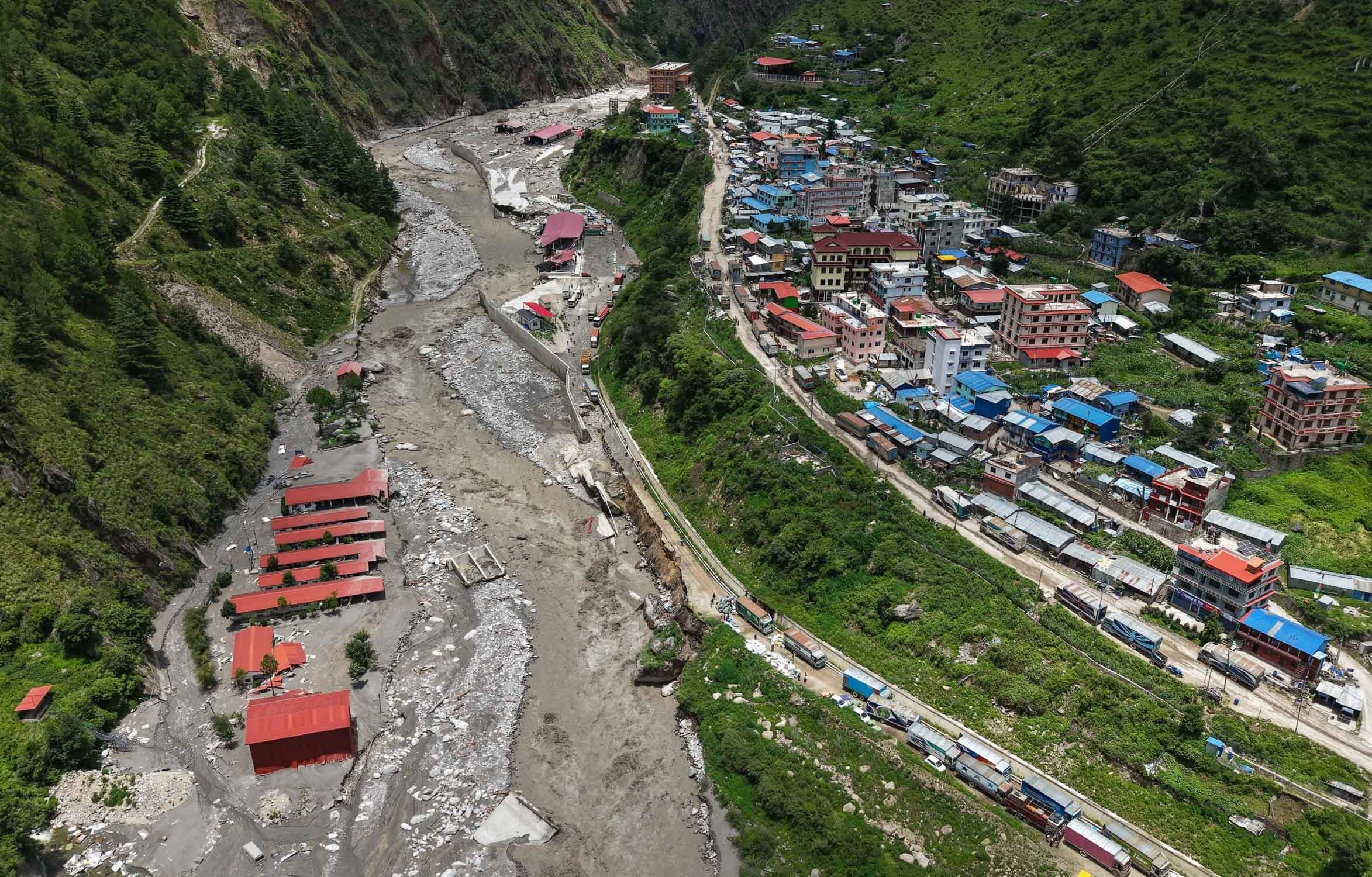
What Is Nepal Hackathon? Nepal-Led Flood Response, Explained
Explainer29 August 20266 min read
A Nepal-led platform pairing local flood responders with engineers, satellite data, compute and funding from anywhere. What it is, how an event runs, and how to join the 30 August kickoff.
By Bijay Bogati — Organiser, Nepal Hackathon
Nepal Hackathon is a Nepal-led platform that connects Nepali responders, researchers and engineers with the people, data, compute and funding they need from the rest of the world. Its current event is the Bhote Koshi–Trishuli flood response, with a kickoff call on Sunday 30 August 2026 at 09:00 NPT. Registration is free and open to anyone, anywhere.
The short version
- What it is: a platform that runs short, focused events on problems Nepal-based teams have already identified.
- Current event: the response to the 26 August 2026 Bhote Koshi–Trishuli flash flood.
- Kickoff: Sunday 30 August 2026, 09:00 NPT — Saturday evening in the Americas.
- Who can join: engineers, data and GIS people, climate scientists, drone operators, designers, economists, translators — and anyone able to offer compute, imagery, connectivity, equipment or funding.
- Cost: free. Register at nepalhackathon.org/register.
What Nepal Hackathon actually is
Nepal has responders, hydrologists, mappers and engineers already working on this. What they do not always have on hand is satellite tasking, GPU time, imagery pipelines, or fifty extra pairs of technical hands on a Sunday. Nepal Hackathon exists to close that gap.
The order matters. Teams in Nepal say what is happening and where help would be useful. Contributors organise around that. Nobody arrives with a solution and goes hunting for a problem to attach it to.
It is not a one-off. The platform is built to run repeated events, so the second one starts with known data sources, known contacts, known gaps and people who have already worked together.
Why this event: the Bhote Koshi–Trishuli flood
On the morning of 26 August 2026, a flash flood tore down the Lhende Khola into the Bhote Koshi and Trishuli rivers, through Rasuwa and on into Nuwakot and Dhading. Roads, bridges, hydropower plants, border infrastructure and whole settlements were destroyed.
The strongest evidence so far points to a large collapse of glacier ice and rock high above the valley, which sent an ice-and-rock avalanche into the river system. ICIMOD reported the flood as it moved downstream, and the U.S. Geological Survey now identifies the seismic signal first read as an earthquake as the landslide itself.
One part of the sequence is still being investigated: whether avalanche debris briefly blocked a narrow stretch of the river, letting water build up before releasing. That would have amplified the flood wave downstream, but it should not yet be described as confirmed. Our fuller explainer, with every source named, is at what caused the Nepal flood.
Casualty and missing-person figures were still moving at the time of writing. Those figures belong to the publishers reporting them, so we link the coverage rather than restate the numbers here.
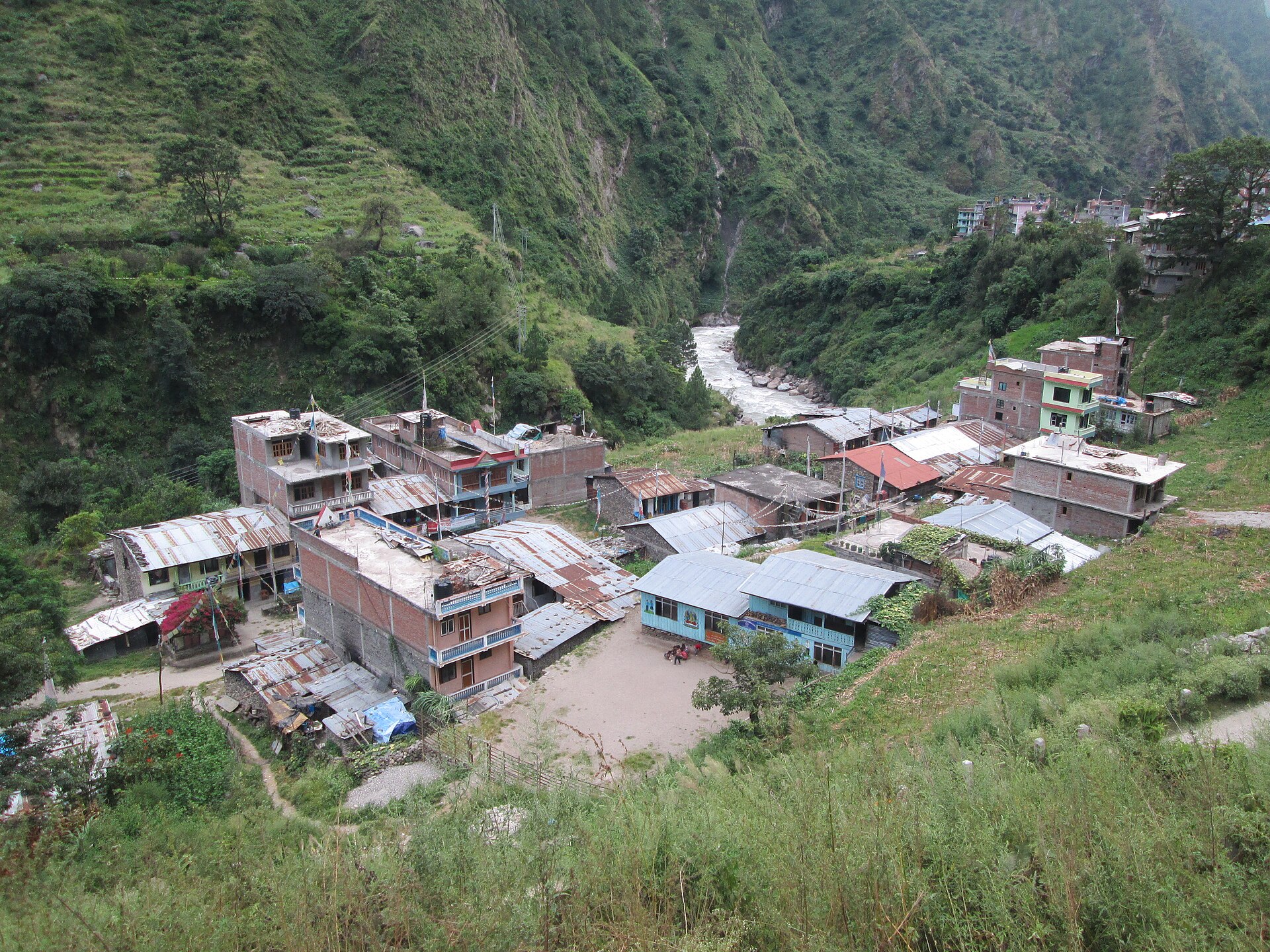
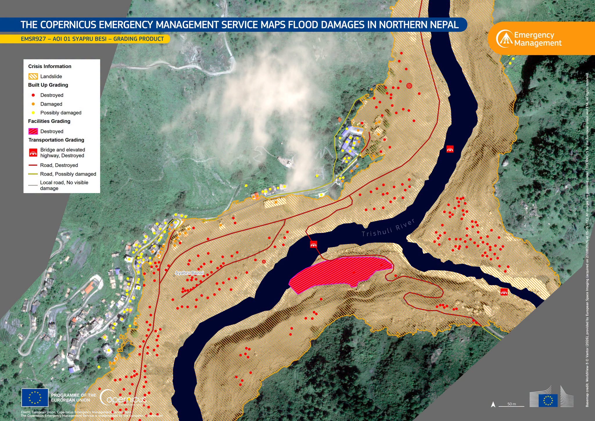
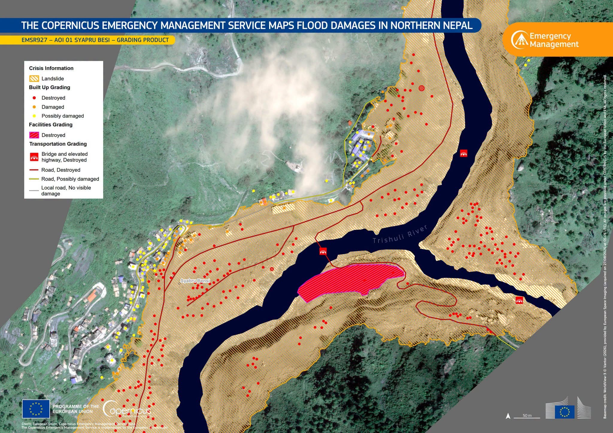
The Copernicus Emergency Management Service was activated to map the flood extent across four areas. In the Syapru Besi area alone its analysis graded more than 240 buildings destroyed and 32 damaged. That is the kind of product several of the project areas below exist to make faster and more local.
The technical work that follows is unusually well suited to a distributed weekend. Satellite scenes need turning into damage maps. Gauge readings, weather records and melt signals sit in separate systems. Drone footage is arriving faster than anyone can process it. That splits across a lot of people in a short stretch of time, wherever they are.
How a Nepal Hackathon event works
- Start with the people doing the work. Nepal-based responders, researchers, drone operators and institutions brief everyone before a line of code gets written.
- Build the team around the problem. You say what you know and how much time you have; you get matched to a problem where that is useful.
- Work live, then keep working async. Teams move fast together during the event, then carry on across time zones.
- Hand over. Nepal-side owners review what was made and decide what continues. Strong projects get connected to 30 days of funding, technology or technical support.
The fourth step is the one that matters. Most hackathon output dies on Monday. Here there is already someone waiting to use it.
What you could work on
These are starting points, not assignments. Real projects get shaped at the kickoff by the teams doing the work.
| Project area | The problem | Skills that fit |
|---|---|---|
| Alert and monitoring | Weather, melt, snow-loss and gauge signals exist but sit in separate systems. Combine them and test whether they flag danger earlier. | Data and GIS · Climate science · AI and engineering |
| Danger zones | Work out what is actually downstream of an event — settlements, roads, bridges, schools, health facilities, hydropower. | Data and GIS · Remote sensing · Climate science |
| Climate-warming risk | Find where glaciers, glacial lakes and terrain are changing fastest, and therefore where monitoring is worth the effort. | Climate science · Remote sensing · Cloud and compute |
| Risk and development | The same flood does different damage depending on road access, comms and healthcare. Show where investment changes the most. | Data and GIS · Economics · Product and design |
| Drones and remote sensing | Nepali drone teams are already flying. The bottleneck is turning footage into damage maps fast enough to matter. | Remote sensing · AI and engineering · Cloud |
| Public health continuity | Add capacity to Nepal’s existing health-emergency institutions rather than standing up a parallel system. | Data and GIS · Product and design · AI |
| Watersheds and recovery | A flood this size moves sediment, damages farmland and creates new landslide risk. How you rebuild either reduces the next one or repeats it. | Climate science · Data and GIS · Economics |
Each area gets a Problem Lead announced at the kickoff. The full write-ups are on the event page, and the companion post on where to start goes deeper on picking one.
The five ground rules
These apply to every event and to anything built at one.
- The agenda comes from Nepal. Work is scoped by the people already doing it.
- Show your sources. Anything published names where it came from, when, and how confident we are.
- No risk scores on named places. Hazard ratings and evacuation guidance for particular settlements belong to the authorities accountable for them.
- Build for the handover. A prototype nobody in Nepal can run is a weekend spent on yourself.
- Nothing that identifies a person. No missing-person lists, no casualty records, in prototypes or on the site.
When the kickoff lands where you are
| City | Local time | Date |
|---|---|---|
| Kathmandu | 09:00 | Sunday 30 August |
| Delhi | 08:45 | Sunday 30 August |
| Singapore | 11:15 | Sunday 30 August |
| Sydney | 13:15 | Sunday 30 August |
| London | 04:15 | Sunday 30 August |
| Berlin | 05:15 | Sunday 30 August |
| New York | 23:15 | Saturday 29 August |
| San Francisco | 20:15 | Saturday 29 August |
The call runs about ninety minutes. The link is emailed once the platform is confirmed.
Four ways to take part
- Volunteer your skills. Two minutes to register. It goes to the Nepal-side Problem Leads so they can match you to a team before kickoff. More on how remote participation works.
- Offer technology or resources. Cloud, GPUs, satellite imagery, APIs, connectivity, equipment, engineers, or continuation funding — see what would help.
- Donate. To the Government of Nepal’s Prime Minister’s Disaster Relief Fund, or through the routes listed on the help page.
- Pass it on. Send it to the one hydrologist, GIS specialist or drone engineer you know. Matching one right person beats a hundred impressions.
What happens after the weekend
| When | What happens |
|---|---|
| 72 hours | Publish what was produced, the data sources behind it, the known limitations, and clear ways to help further. |
| 30 days | Keep alive the projects Nepal partners want to carry forward, with the support they ask for. |
| 90 days | Pilot the strongest tools with the people and institutions who would actually use them. |
| Beyond | Maintain a network Nepali responders and researchers can call on for talent, technology and funding — including after the news moves on. |
Frequently asked questions
What is Nepal Hackathon?
Nepal Hackathon is a Nepal-led platform that runs short, focused technical events on problems Nepali responders and researchers have identified. It connects them with engineers, scientists, mappers, satellite data, cloud compute and funding from around the world. The current event is the Bhote Koshi–Trishuli flood response.
When is the Nepal Hackathon kickoff?
The kickoff call is Sunday 30 August 2026 at 09:00 NPT, which is Saturday evening in North America. It runs roughly ninety minutes. Nepal-based teams brief everyone on the situation and what help is useful, then teams form around those requests.
Do I need to be in Nepal to join?
No. The event is led from Nepal but open to anyone, anywhere. Contributors work live during the kickoff and build weekend, then continue asynchronously across countries and time zones. Everything is remote.
Is it free to register?
Yes. Registration is free and takes about two minutes. The form asks what you know, how much time you can commit, whether you can make the kickoff, and anything concrete you can offer such as compute, data or equipment.
What skills are needed?
Data and GIS, climate science, drones and remote sensing, AI and engineering, cloud and compute, product and design, economics, and translation. Non-technical help matters too: coordination, writing and outreach. If you can only offer resources rather than time, that also counts.
I am not a developer. Can I still help?
Yes. Organisations can offer cloud credits, GPUs, satellite tasking, APIs, connectivity, equipment or continuation funding. Individuals can donate, or share the event with technical people who would be a fit.
What caused the 26 August 2026 flood?
The strongest evidence so far points to a large collapse of glacier ice and rock high above the Lhende Khola, which sent an ice-and-rock avalanche into the river system and a surge of water, mud and rock downstream into the Bhote Koshi and Trishuli. Whether debris briefly blocked the river and amplified the wave is still under investigation and is not confirmed.
Does Nepal Hackathon publish casualty or missing-person data?
No. One of the platform’s ground rules is that nothing published identifies a person — no missing-person lists and no casualty records. Third-party news coverage is linked with the publisher named, and those figures are the publishers’ own and unverified by the project.
What happens to projects after the weekend?
Nepal-side owners review what was built and decide what continues. Projects they want to carry forward get connected to 30 days of funding, technology or technical support, with piloting at 90 days. Work that nobody in Nepal can run does not continue.
Take part
Registration is open and free. Two minutes, and it puts you in front of the Nepal-side Problem Leads before the kickoff — and on the list for whatever comes next.
Register for the Nepal flood response. Questions: hello@nepalhackathon.org. Corrections: corrections@nepalhackathon.org.
- Nepal Hackathon
- Nepal flood response 2026
- Bhote Koshi Trishuli flood
- volunteer tech skills Nepal
- Rasuwa flood help